
Commercial Roof Drone Assessments
Fiber‑G drone assessments support commercial roof evaluation, documentation, restoration planning, and verification — a fast, safe way to see the true condition of your roof before making decisions.
What we capture
Capabilities
High-Resolution Aerial Imaging
Full-roof photo and 4K video coverage captured safely from the air — no ladders, no foot traffic on the membrane.
Thermal (Infrared) Scans
Temperature mapping that flags moisture intrusion, wet insulation, and hidden voids invisible to the eye.
Measurements & Takeoffs
Accurate roof dimensions, square footage, penetrations, and drainage details for precise restoration planning.
Storm & Damage Documentation
Hail, wind, and wear documentation for insurance claims, capital planning, and warranty records.
Condition Reports
Organized, photo-referenced reports that show the current state of every roof section.
Restoration Verification
Before-and-after imaging that verifies Fiber‑G system installation and supports warranty documentation.
Case study
See the Difference Beyond the Surface
Our drone assessments combine high-resolution aerial imagery with thermal imaging to help document visible roof conditions and surface-temperature patterns. These before-and-after images show the transformation from an aged, heat-absorbing roof to a seamless, reflective Fiber‑G restored surface.
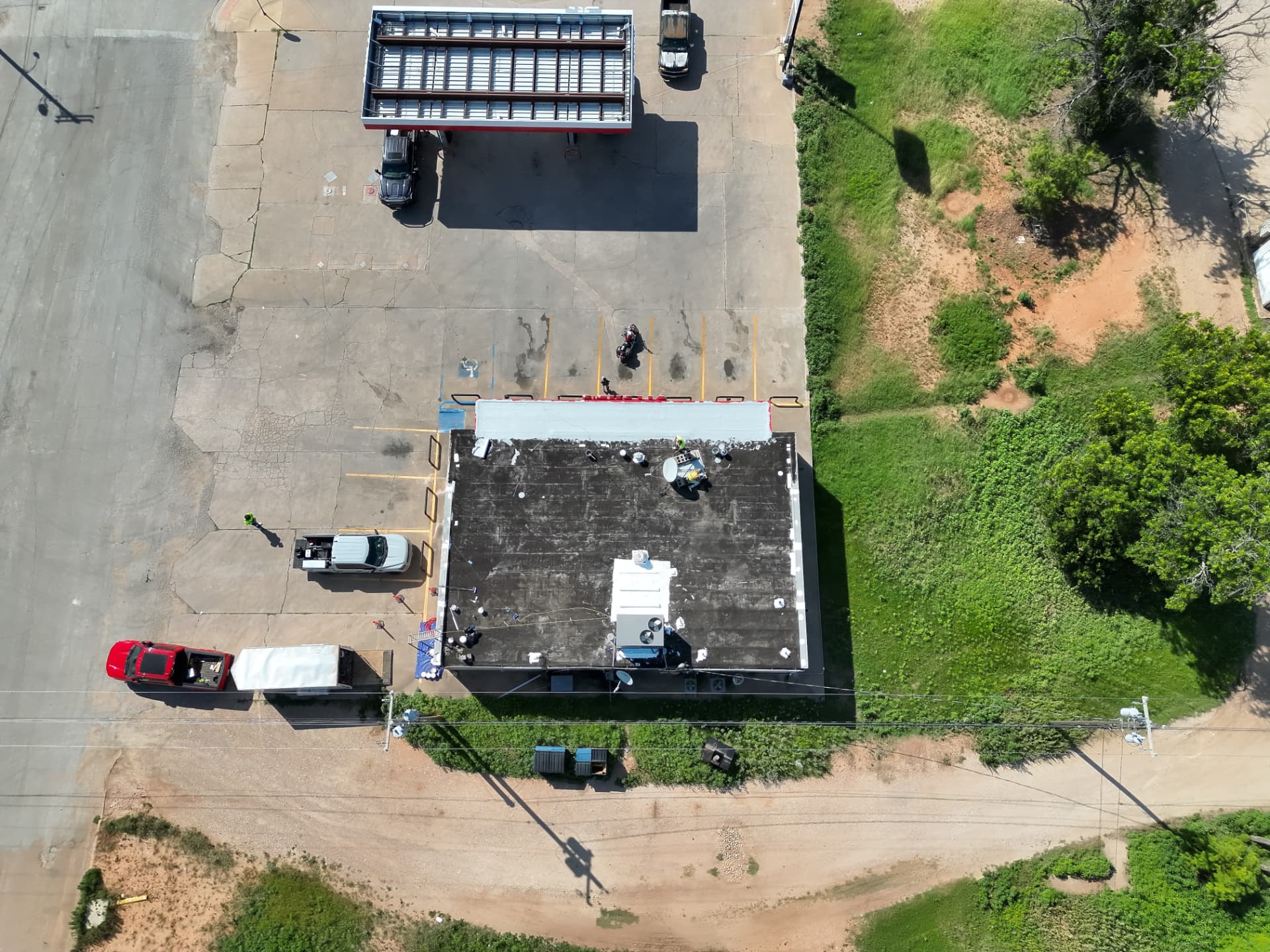 Before
Before Restoration
Dark, heat-absorbing roof surface
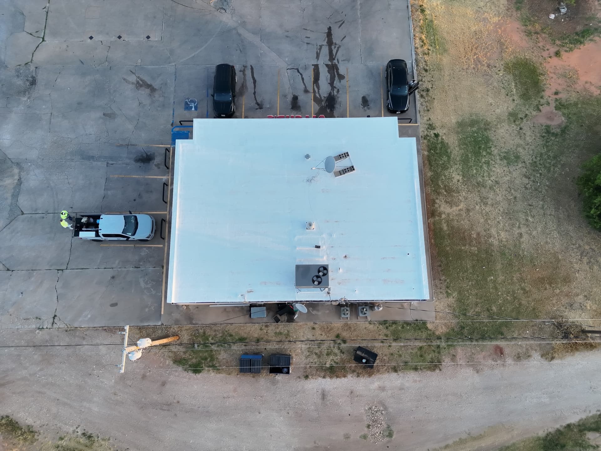 After
AfterAfter Fiber‑G Restoration
Bright, reflective, protected roof surface
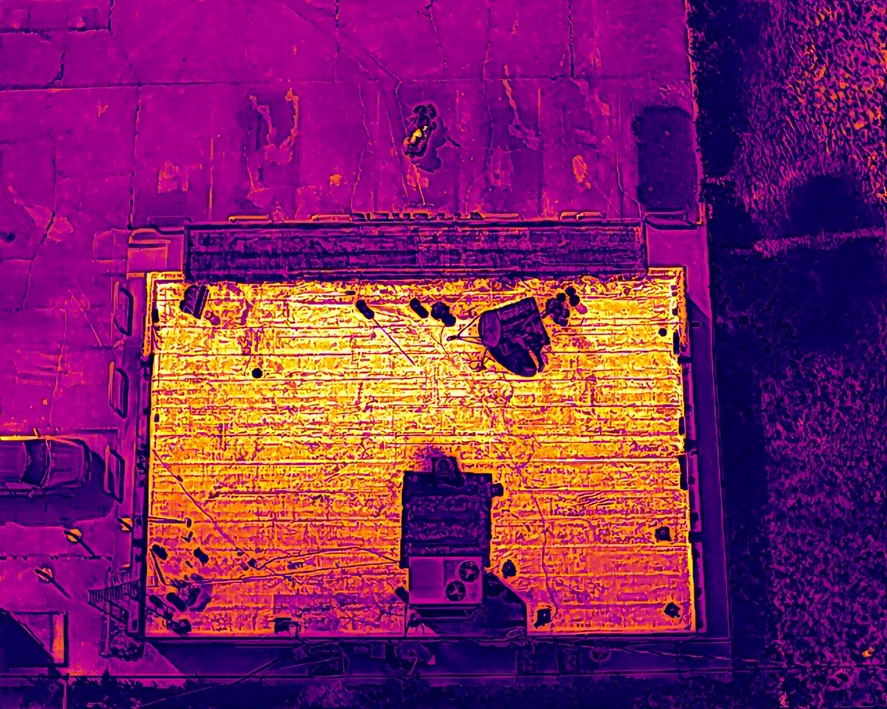 Before
Before Thermal Reading
Widespread warmer surface conditions
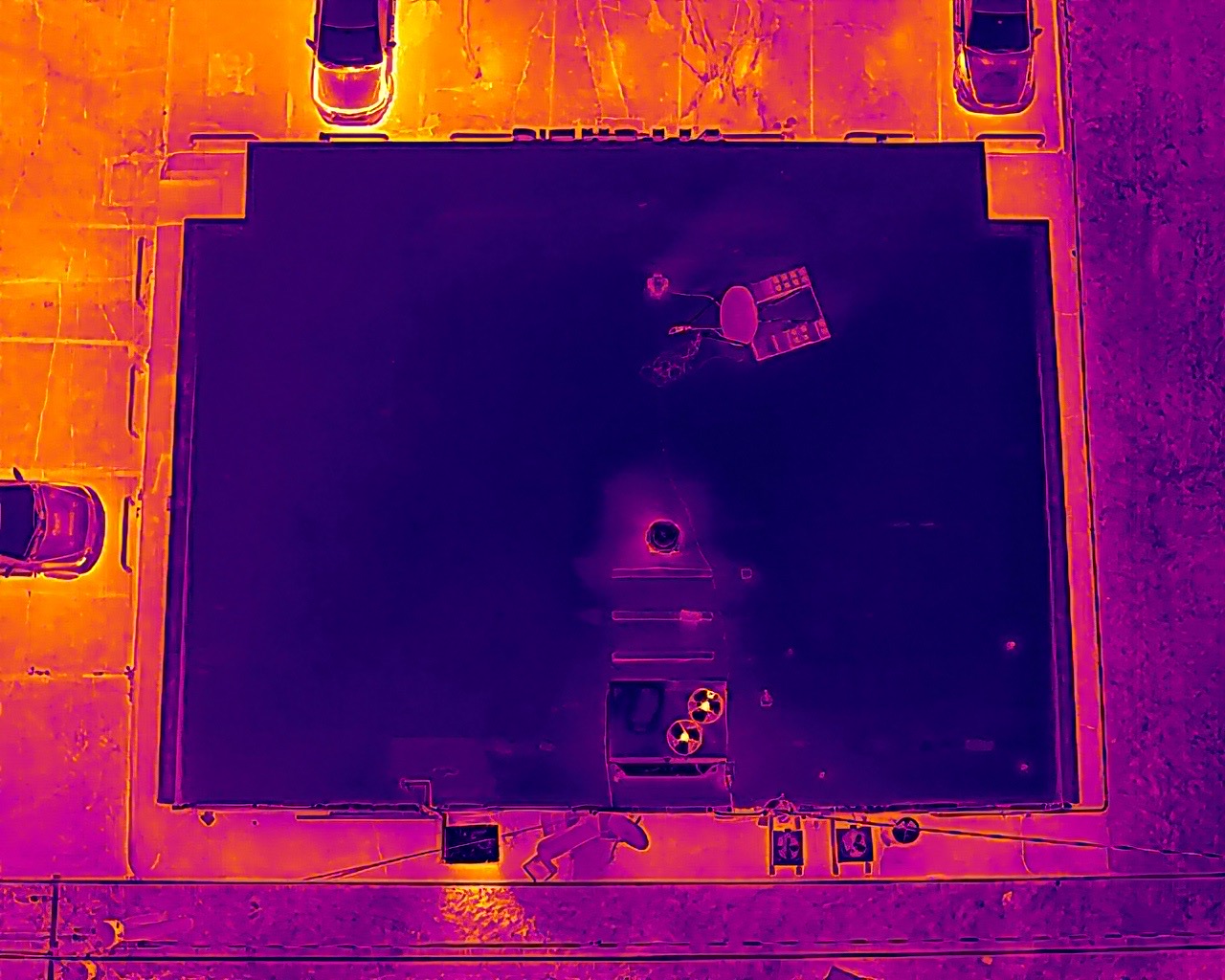 After
AfterAfter Thermal Reading
Visibly cooler roof surface relative to surrounding areas
Thermal images use color to show relative surface-temperature patterns. Brighter yellow and orange areas represent relatively warmer surfaces, while darker purple areas represent relatively cooler surfaces. The restored roof appears visibly cooler relative to surrounding areas under the conditions present when these images were captured.
How it works
Our Process
Assess
We fly the roof and capture complete aerial coverage, establishing the overall condition of the system.
Document
Every section is photographed and recorded — penetrations, seams, drains, and equipment locations included.
Analyze
Imaging and thermal data are reviewed to identify damage, moisture, and areas of concern.
Recommend
Findings become a clear restoration plan — what to restore, where, and with which Fiber‑G system.
Verify
Post-restoration flights confirm the work, delivering documented before-and-after proof.
Next step
See Your Roof Clearly Before You Spend on It
A drone assessment is the smartest first step in any commercial roof project. Call us to schedule an evaluation of your property.